Bark Beetle Incident Watershed Assessments
Project Summary
Completion Date: 2011
Partner
USDA Forest Service
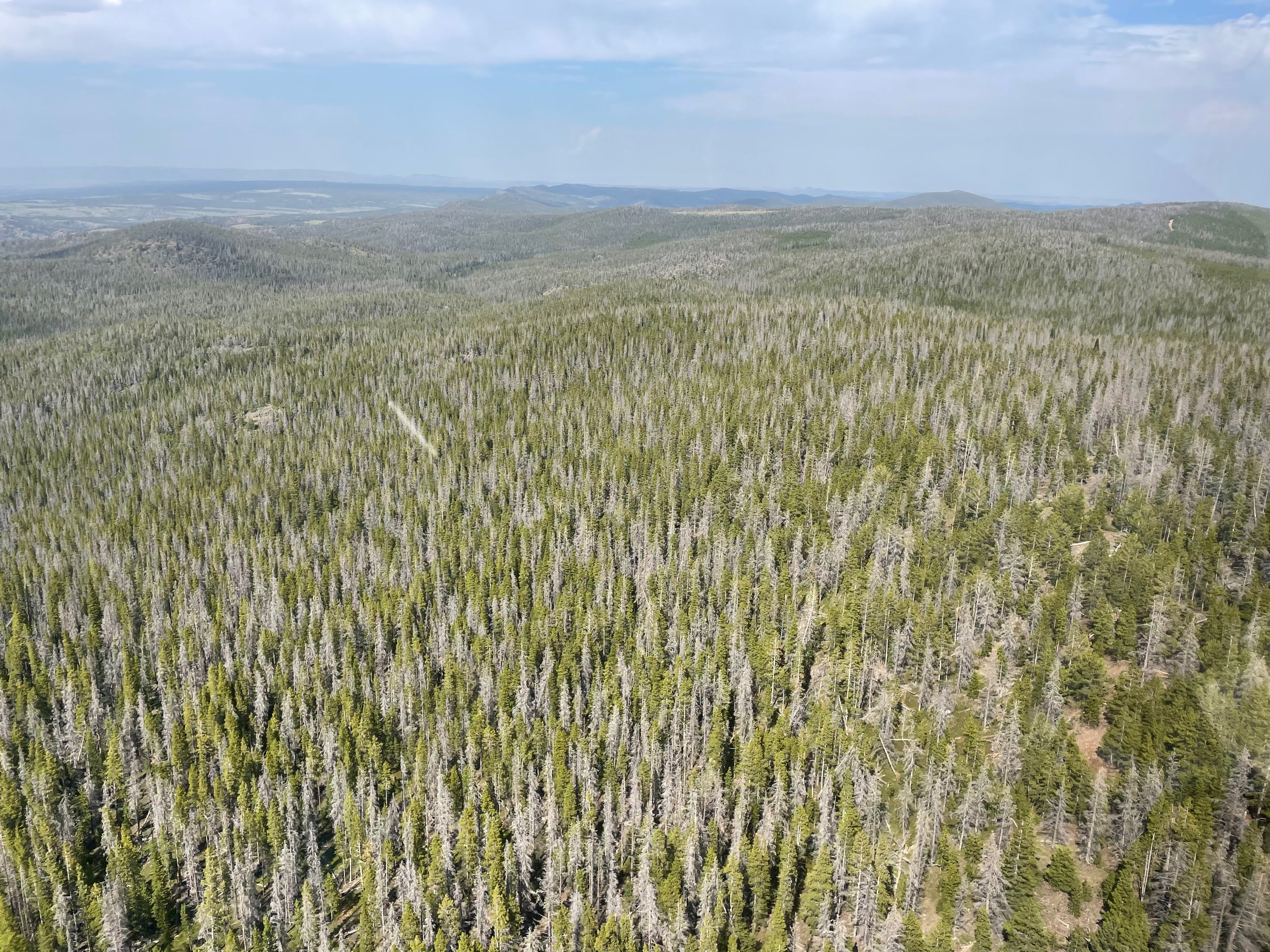
JWA completed a project to provide the technical components of watershed assessments for the Bark Beetle Incident area on the Medicine Bow/Routt, Arapahoe/Roosevelt and portions of the White River National Forests in Colorado and Wyoming. JW Associates completed 12 Phase 1 Watershed Assessments for the USDA Forest Service's Bark Beetle Incident (BBI) team in the Rocky Mountain Region (Region 2). These Watershed Assessments cover the following three National Forests:
White River National Forest
Medicine Bow-Routt National Forests
Arapaho-Roosevelt National Forests
Project Actions
Watershed prioritization within 15, 5th level watersheds based in part on wildfire hazard.
Fire hazard modeling to identify areas of concern
Application of Fire Behavior Assessment Tool (FBAT) using LANDFIRE data with adjustments based on forest mortality from bark beetle infestation.
Benefits
Mitigate negative effects of wildfire through targeted projects & planning efforts
Map of BBI Assessment Watersheds
Descriptions, maps and assessment reports for each of the watersheds are below. Clicking on the maps provides a larger map that shows the locations and 6th level watersheds used for prioritization.

Overview map of assessment areas
Click on map to enlarge
Big Thompson
The fourth-level Big Thompson Watershed was modified because the watersheds on the plains would skew the results of the prioritization.
The Big Thompson Watershed Assessment has been taken further through the stakeholder process. That process provided a final prioritization and an opportunities and constraints analysis. Please refer to the Big Thompson Watershed/Wildfire Assessment page for information on that work.
Blue River Watershed
The fourth-level Blue River Watershed was modified because the one of the watersheds was lower in elevation and not forested and would skew the results of the prioritization.
The Blue River Watershed Assessment has been taken further through the stakeholder process. That process has provided a final prioritization and an opportunities and constraints analysis. Please refer to the Blue River Wildfire/Watershed Assessment page for information on that work.
Click on map to enlarge
Click on map to enlarge
Cache La Poudre
The fourth-level Cache La Poudre Watershed was modified because the watersheds on the plains would skew the results of the prioritization.
The Cache La Poudre Watershed Assessment has been taken further through the stakeholder process. That process provided a final prioritization and an opportunities and constraints analysis. Please refer to the Cache La Poudre Watershed/Wildfire Assessment page for information on that work.
Clear / Bear Creek
This watershed is a combination of the fourth-level Clear Creek Watershed and the fifth-level Bear Creek Watershed. They were combined because:
Clear Creek is a small fourth-level watershed
Bear Creek is part of the Upper South Platte Watershed that has been assessed before Bear Creek became part of the fourth-level Upper South Platte watershed.
They are adjacent and similar in the characteristics that are in this assessment.
The watershed assessment area was modified because the watersheds on the plains would skew the results of the prioritization.
Click on map to enlarge
Click on map to enlarge
Crow/Medicine Bow/Upper Laramie/Upper Lodgepole
This watershed assessment followed a procedure prescribed by the Front Range Watershed Protection Data Refinement Work Group titled “Protecting Critical Watersheds in Colorado from Wildfire: A Technical Approach to Watershed Assessment and Prioritization”. See Watershed Wildfire Protection Group for more information.
This watershed is composed of portions of the following 4 fourth-level watersheds:
Crow
Medicine Bow
Upper Laramie
Upper Lodgepole
The Phase 1 analysis has been completed. Please review the report for more information.
Eagle River
This watershed assessment followed a procedure prescribed by the Front Range Watershed Protection Data Refinement Work Group titled “Protecting Critical Watersheds in Colorado from Wildfire: A Technical Approach to Watershed Assessment and Prioritization”. See Watershed Wildfire Protection Group for more information.
This watershed is composed of the fourth-level Eagle River watershed. Portions of the Headwaters of the Eagle River (French Creek-Homestake Creek watershed) have been included in the Arkansas Headwaters Wildfire/Watershed Assessment.
The Phase 1 analysis has been completed. Please review the report for more information.
Click on map to enlarge
Click on map to enlarge
Little Snake
This watershed assessment followed a procedure prescribed by the Front Range Watershed Protection Data Refinement Work Group titled “Protecting Critical Watersheds in Colorado from Wildfire: A Technical Approach to Watershed Assessment and Prioritization”. See Watershed Wildfire Protection Group for more information.
During the preliminary analysis it became obvious that the western portion of the watershed was much different from the eastern portion. A smaller assessment area was used in the analysis.
The Phase 1 analysis has been completed. Please review the report for more information
Lower Colorado Headwaters
This watershed assessment followed a procedure prescribed by the Front Range Watershed Protection Data Refinement Work Group titled “Protecting Critical Watersheds in Colorado from Wildfire: A Technical Approach to Watershed Assessment and Prioritization”. See Watershed Wildfire Protection Group for more information.
The Lower Colorado Headwaters watershed is the lower part of the fourth-level Colorado Headwaters watershed. That watershed has been divided into two parts for these Phase 1 assessments. The upper portion of the Colorado Headwaters watershed is being assessed as the Upper Colorado Headwaters watershed.
The Phase 1 analysis has been completed. Please review the report for more information.
Click on map to enlarge
Click on map to enlarge
North Platte
This watershed assessment followed a procedure prescribed by the Front Range Watershed Protection Data Refinement Work Group titled “Protecting Critical Watersheds in Colorado from Wildfire: A Technical Approach to Watershed Assessment and Prioritization”. See Watershed Wildfire Protection Group for more information.
The North Platte watershed is fourth-level watershed. The Phase 1 analysis has been completed. Please review the report for more information.
Roaring Fork
This watershed assessment followed a procedure prescribed by the Front Range Watershed Protection Data Refinement Work Group titled “Protecting Critical Watersheds in Colorado from Wildfire: A Technical Approach to Watershed Assessment and Prioritization”. See Watershed Wildfire Protection Group for more information.
The Roaring Fork watershed is fourth-level watershed. Portions of the Headwaters of the Roaring Fork Watershed (portions of the Roaring Fork and Fryingpan Headwaters) have been included in the Arkansas Headwaters Wildfire/Watershed Assessment.
The Phase 1 analysis has been completed. Please review the report for more information.
Click on map to enlarge
Click on map to enlarge
Saint Vrain
This watershed assessment followed a procedure prescribed by the Front Range Watershed Protection Data Refinement Work Group titled “Protecting Critical Watersheds in Colorado from Wildfire: A Technical Approach to Watershed Assessment and Prioritization”. See Watershed Wildfire Protection Group for more information.
The fourth-level Saint Vrain Watershed was modified because the watersheds on the plains would skew the results of the prioritization. The Phase 1 analysis has been completed. Please review the report for more information.
The Saint Vrain Watershed Assessment has been taken further through the stakeholder process. That process has provided a final prioritization and an opportunities and constraints analysis. Please refer to the Saint Vrain Watershed/Wildfire Assessment page for information on that work.
Upper Colorado Headwaters
This watershed assessment followed a procedure prescribed by the Front Range Watershed Protection Data Refinement Work Group titled “Protecting Critical Watersheds in Colorado from Wildfire: A Technical Approach to Watershed Assessment and Prioritization”. See Watershed Wildfire Protection Group for more information.
The Upper Colorado Headwaters watershed is the upper part of the fourth-level Colorado Headwaters watershed. That watershed has been divided into two parts for these Phase 1 assessments. The lower portion of the Colorado Headwaters watershed is being assessed as the Lower Colorado Headwaters watershed.
The Upper Colorado Headwaters Watershed Assessment has been taken further through the stakeholder process. That process has provided a final prioritization. Please refer to the Upper Colorado Watershed Assessment page for information on that work.
Click on map to enlarge
Click on map to enlarge
Upper North Platte
This watershed assessment followed a procedure prescribed by the Front Range Watershed Protection Data Refinement Work Group titled “Protecting Critical Watersheds in Colorado from Wildfire: A Technical Approach to Watershed Assessment and Prioritization”. See Watershed Wildfire Protection Group for more information.
The Upper North Platte watershed is fourth-level watershed. During the preliminary analysis it became obvious that the northern portion of the watershed was much different from the southern portion. A smaller assessment area is used in this analysis.
The Phase 1 analysis has been completed. Please review the report for more information.
Upper White
This watershed assessment followed a procedure prescribed by the Front Range Watershed Protection Data Refinement Work Group titled “Protecting Critical Watersheds in Colorado from Wildfire: A Technical Approach to Watershed Assessment and Prioritization”. See Watershed Wildfire Protection Group for more information.
This watershed is the fourth-level Upper White Watershed. The watershed assessment area was modified because the watersheds on flatter ground outside of the forested areas would skew the results of the prioritization. The following fifth-level watersheds were removed from the assessment area:
Crooked Wash-White River
Strawberry Creek-White River, except for the sixth-level watershed Flag Creek that was retained in the assessment area
The Phase 1 analysis has been completed. Please review the report for more information.
Click on map to enlarge
Click on map to enlarge
Upper Yampa
This watershed assessment followed a procedure prescribed by the Front Range Watershed Protection Data Refinement Work Group titled “Protecting Critical Watersheds in Colorado from Wildfire: A Technical Approach to Watershed Assessment and Prioritization”. See Watershed Wildfire Protection Group for more information.
This watershed is the fourth-level Upper Yampa Watershed.
The Phase 1 analysis has been completed. Please review the report for more information.