Salt Lake City Watershed Management Plan
Project Summary
2020 - Present
Partners
Salt Lake City Department of Public Utilities
US Forest Service
Salt Lake County
Town of Alta
Utah Department of Transportation
Alta, Snowbird, Brighton, and Solitude Ski Resorts
Martin & Nicholson Environmental Consulting - Salt Lake City, UT
Jacobs - Salt Lake City, UT
EMPSi - Reno, NV
Salt Lake City is the fastest growing city in the United States.
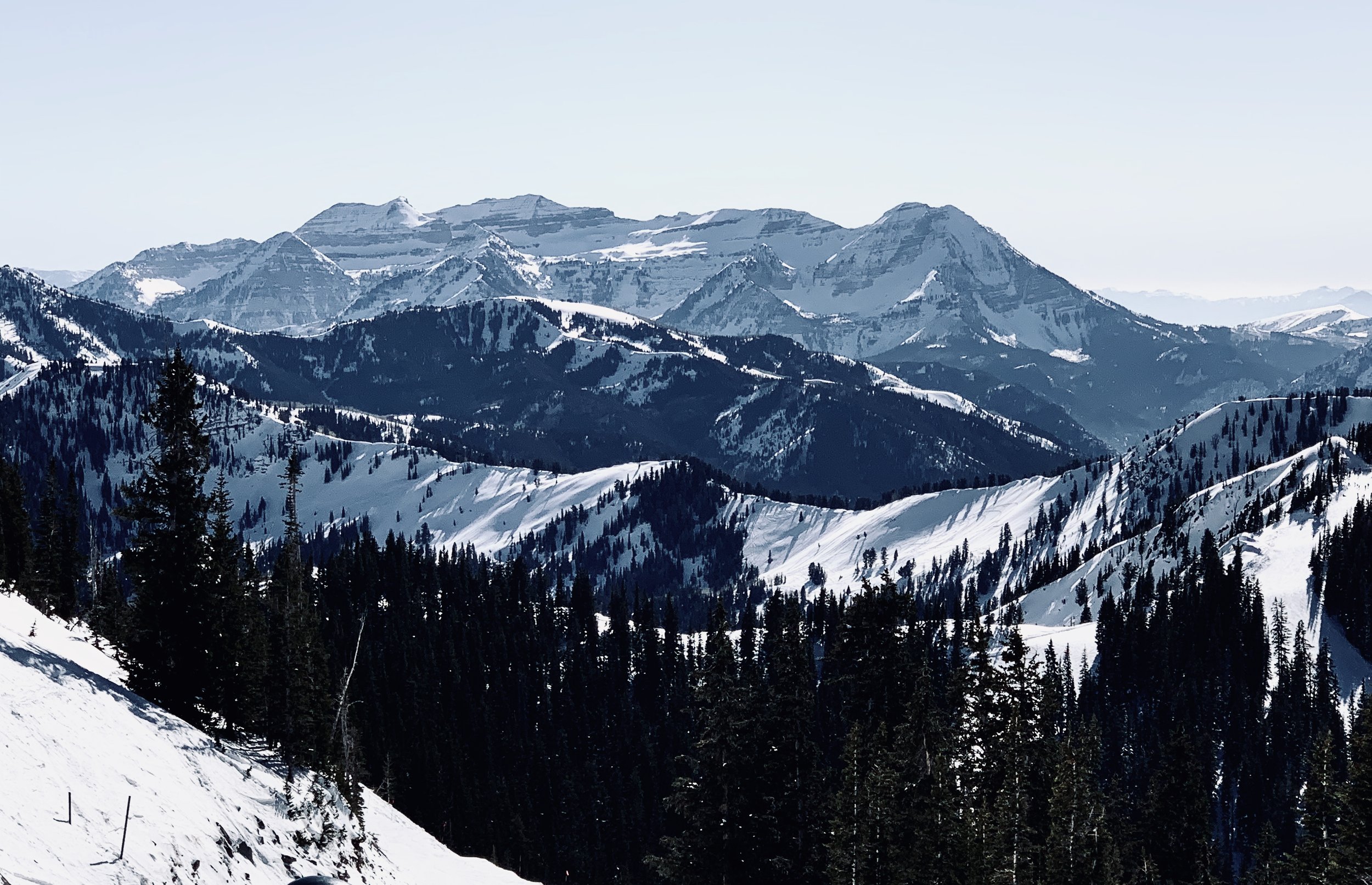
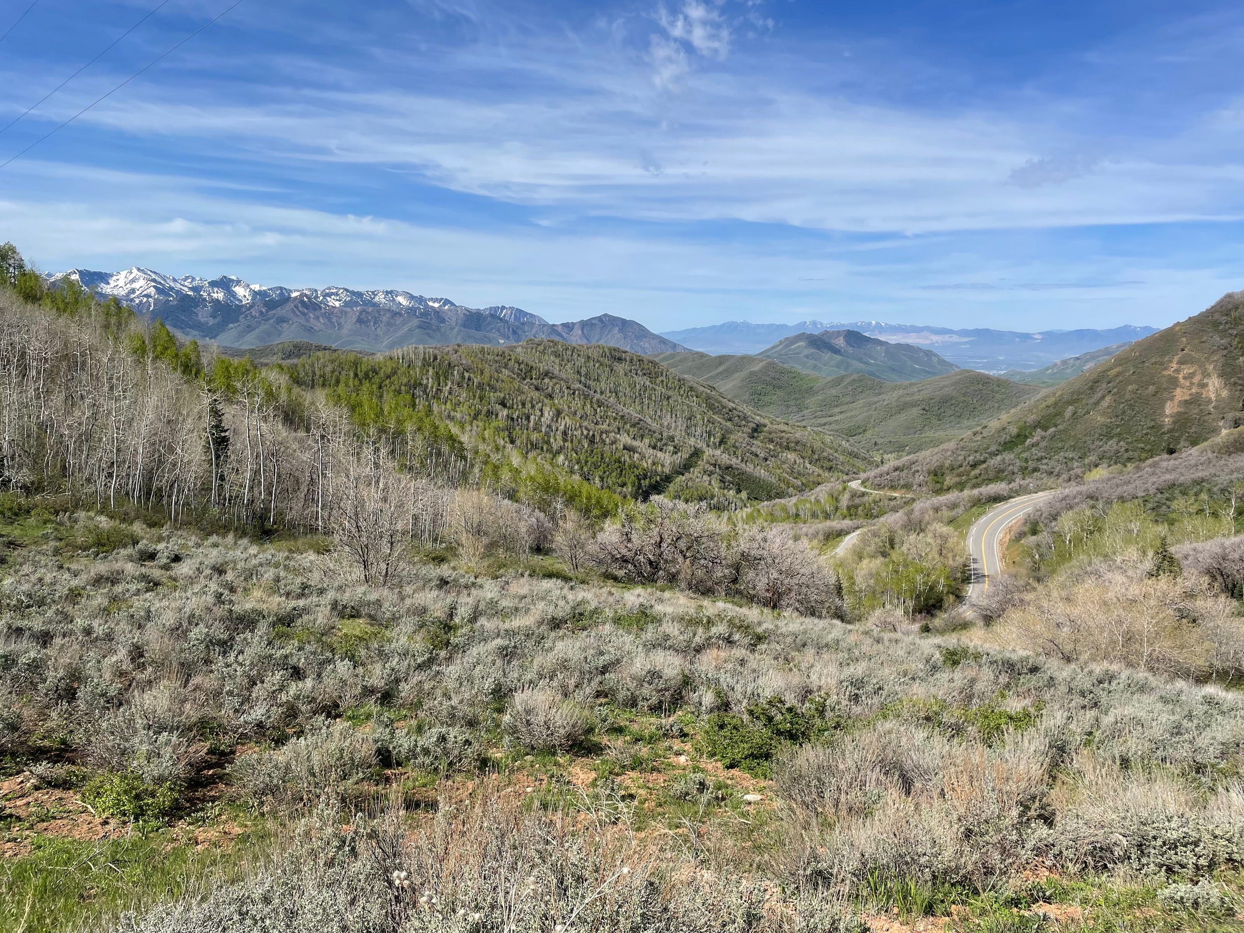
Salt Lake City adopted a Watershed Management Plan (WMP) in 1999, which was updated in 2014 and is used by the Salt Lake City Department of Public Utilities (SLCDPU) to formulate its watershed policies and programs, as well as their implementation. Since 1999, there have been many changes in the underlying conditions related to the protection of Salt Lake City’s surface water supply. Supplying water to roughly 350,000 people, SLCDPU water service area encompasses Salt Lake City and several Salt Lake County cities, including Mill Creek, Cottonwood Heights, Holladay, and others. For over a century, SLCDPU has worked to protect its main sources of culinary water that originate in the headwaters of the Wasatch Mountains located east of the Salt Lake Valley. These water supplies emanate from the Little Cottonwood, Big Cottonwood, Parleys, City, Emigration, Red Butte and Mill Creek watersheds.
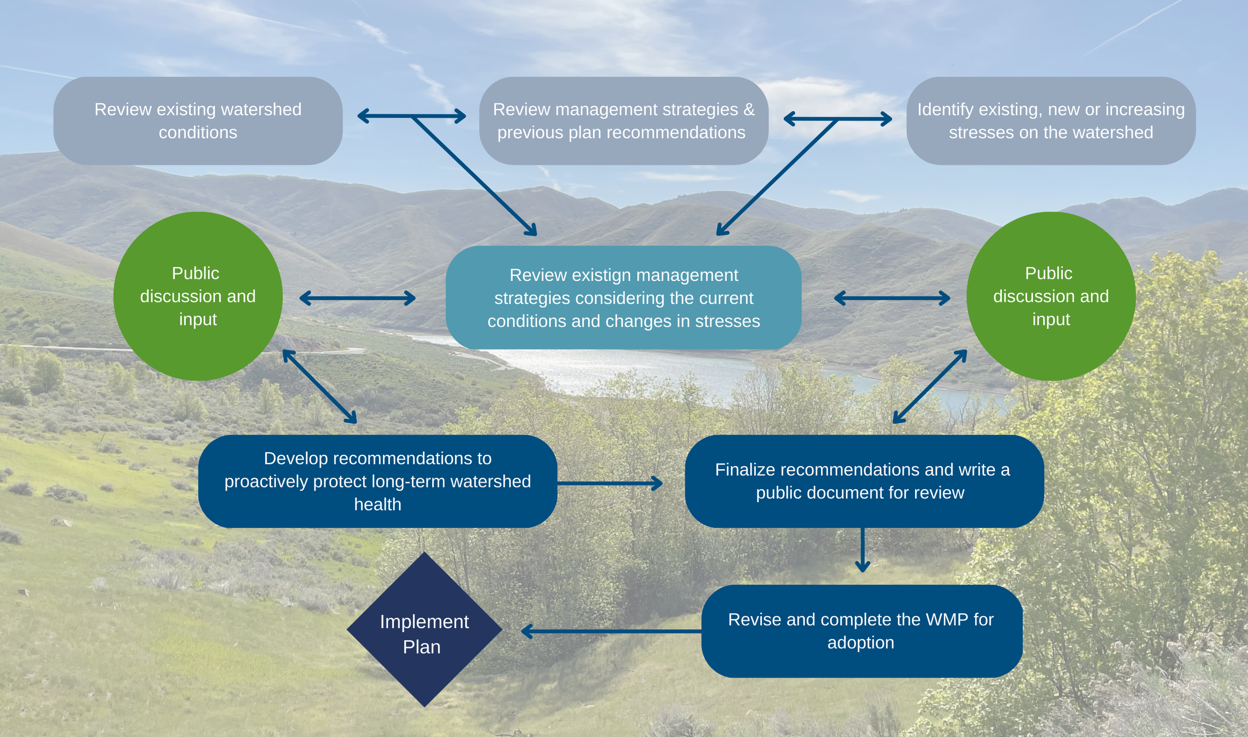
JW’s current project updates and expands Salt Lake City’s existing (WMP). The proposed scope is divided into six tasks; Project Management, Stakeholder Involvement, Watershed Assessment, Identifying and Analyzing Values, Recommendations, and Reviewing and Updating Previous Plan. The WMP update will consider and incorporate new threats and vulnerabilities to Salt Lake City’s surface water supply in the protected watersheds and future potential surface water supplies.
Project Actions
Project Management
Facilitate stakeholder and public involvement with the planning process
Review and update previous WMP
Watershed Assessment and prioritization of high hazard watersheds for treatment and planning purposes
Identify and assess the potential for impacts to the water supply system, caused by natural and human-influenced events
Provide recommendations for high hazard watersheds based on a singular, holistic, incorporated watershed program
Benefits
Protect critical water supplies and natural resources in the greater Salt Lake City Watershed
Mitigate negative effects of future severe wildfires with pre-fire forest/vegetation treatments
Protect river ecosystem functions and health and create recommendations to create a more resilient river corridor
Develop a plan for current and future recreation and human use of these critical watersheds
Develop a resilient watershed that can withstand impacts of climatic changes
Process of Project
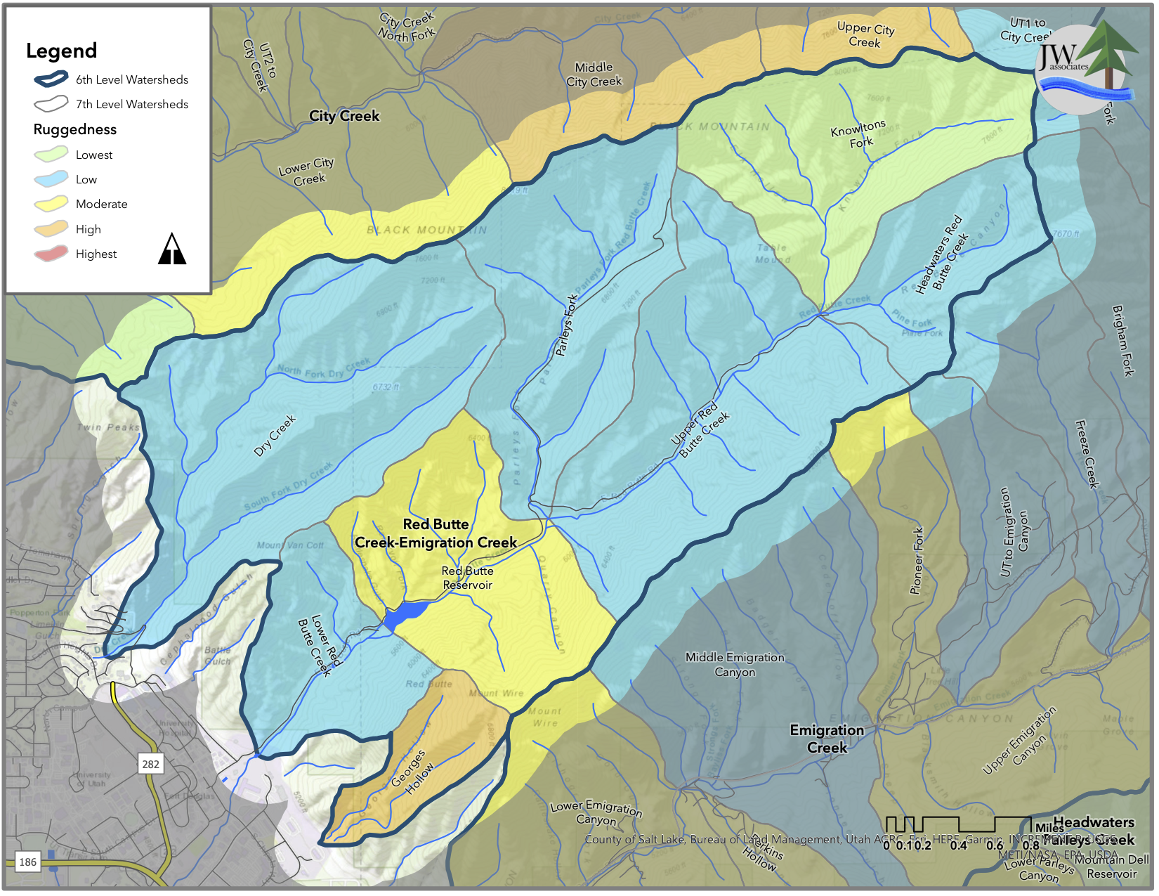
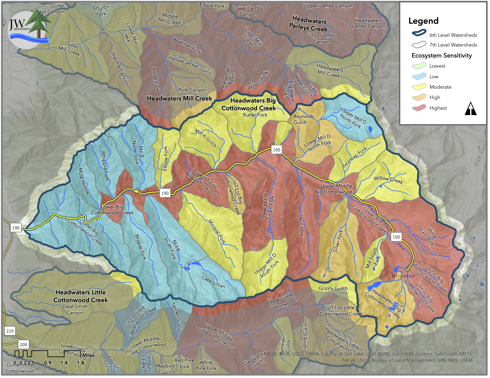
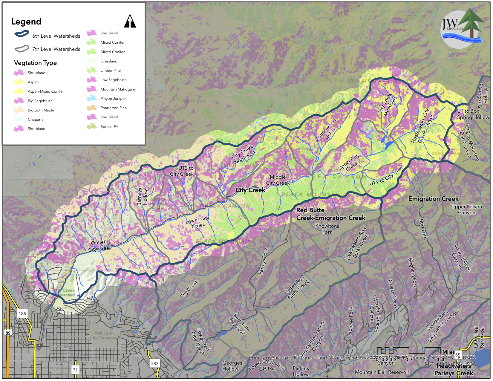
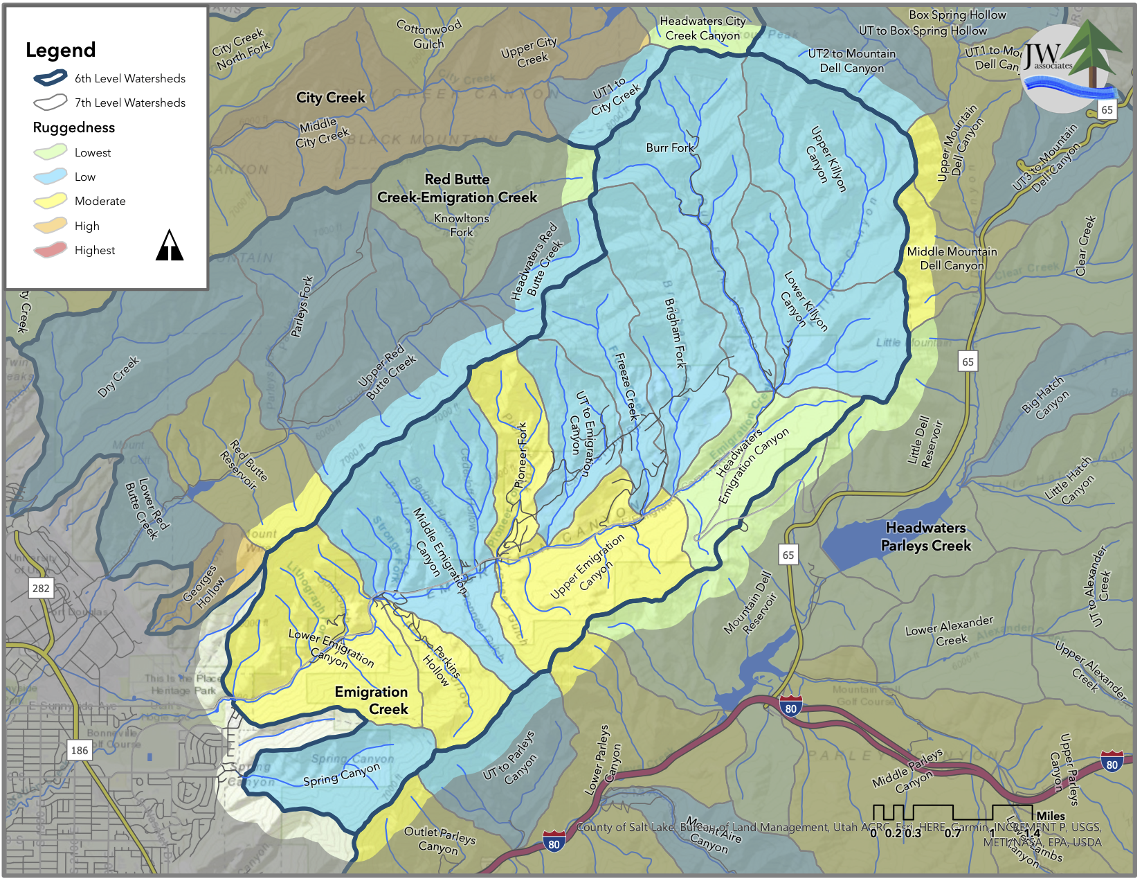
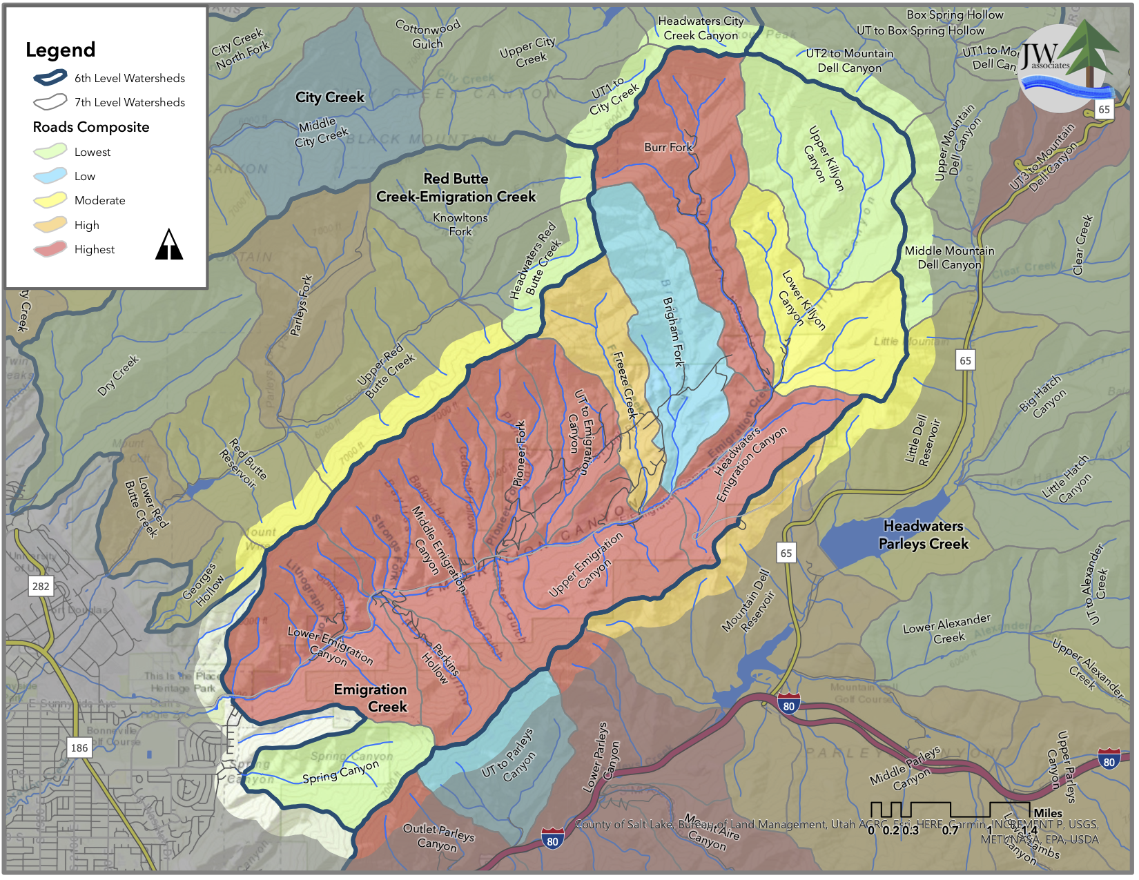
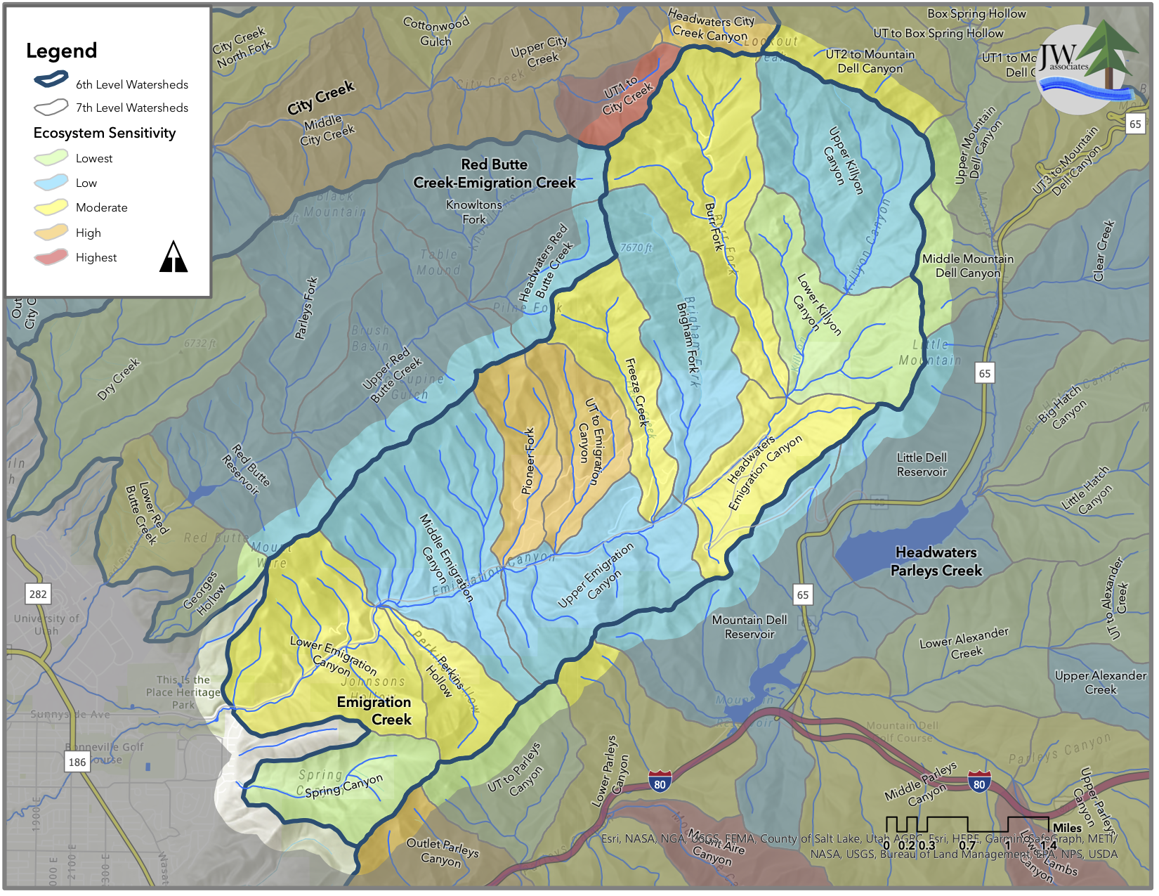
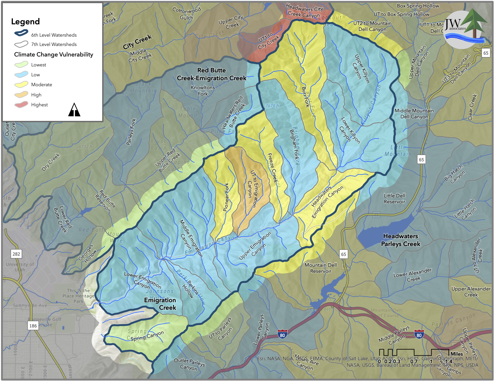
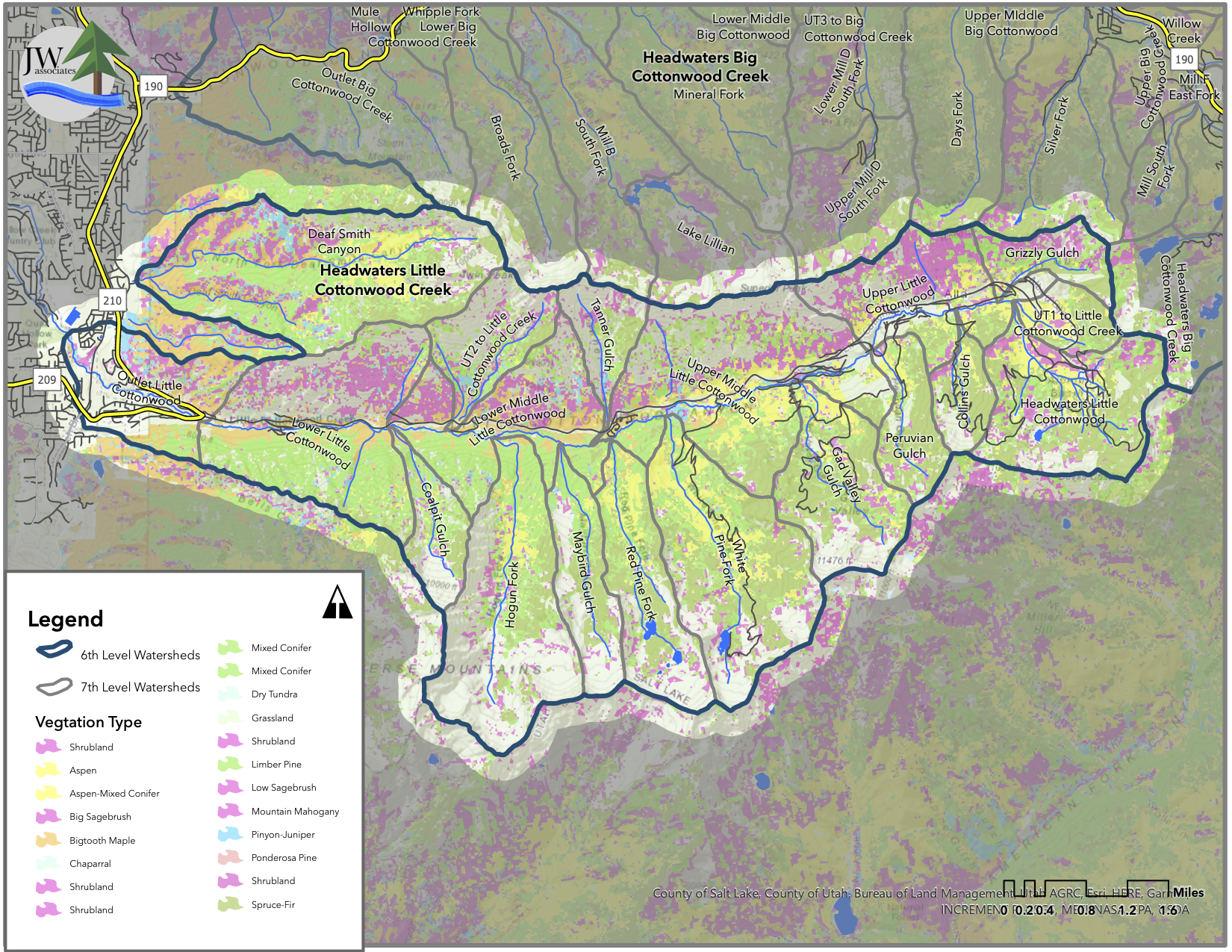
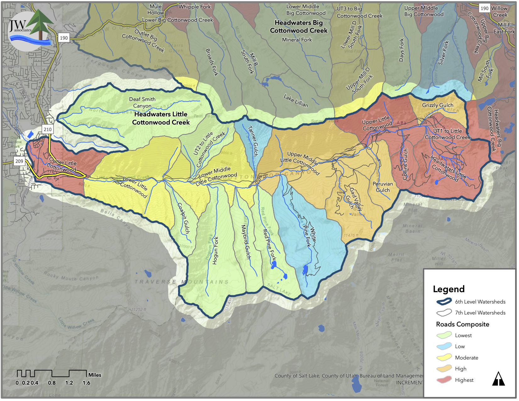
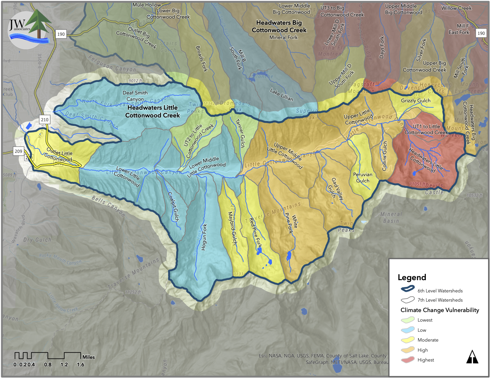
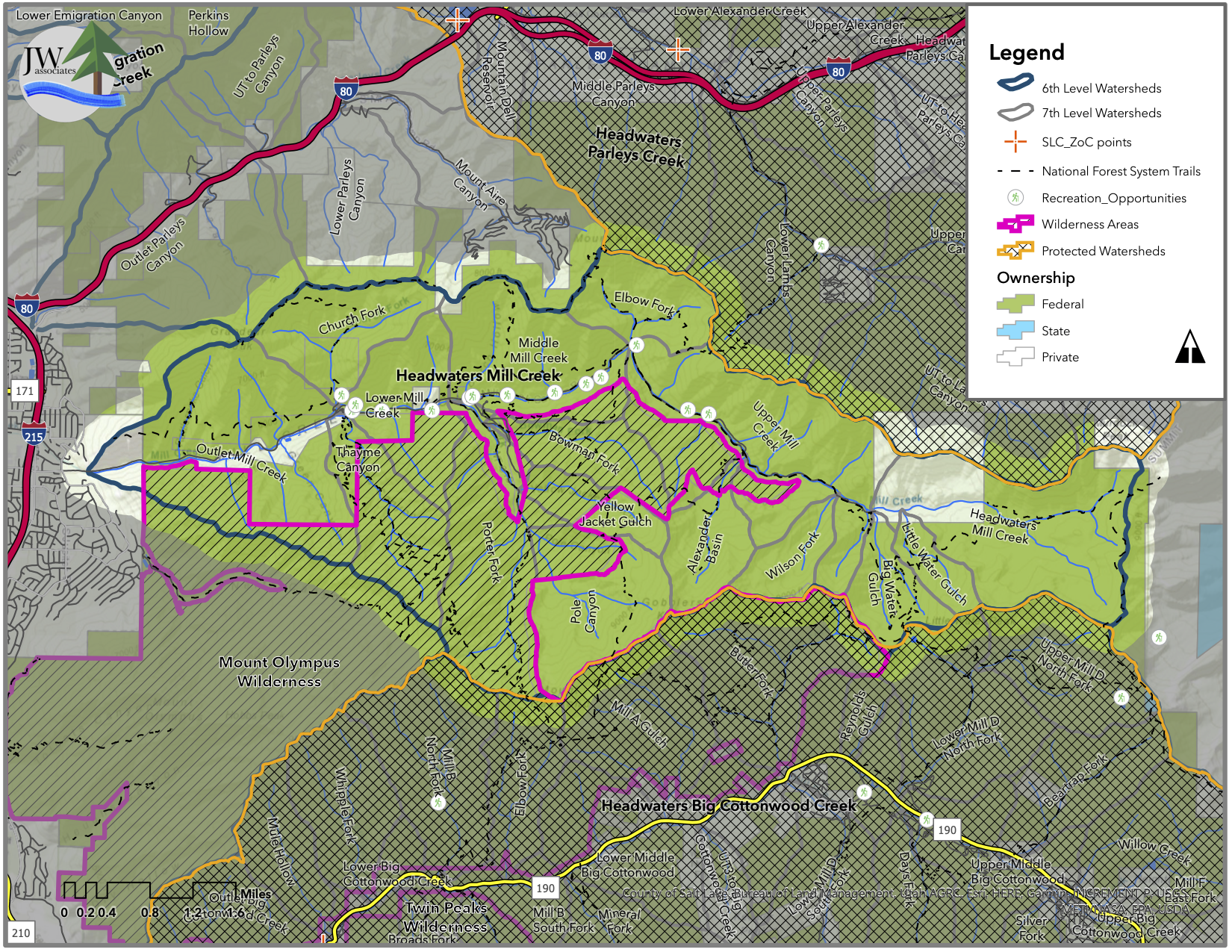
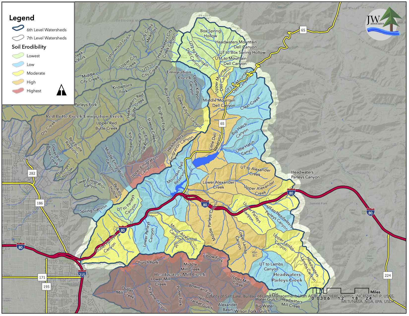
Maps
The maps in the slide show below are from the Salt Lake City Watershed Management Planning process. Click on the slide show to view the priority maps. The legend text identifies the ranking item.
Salt Lake City Overview Maps


Big Cottonwood


City Creek


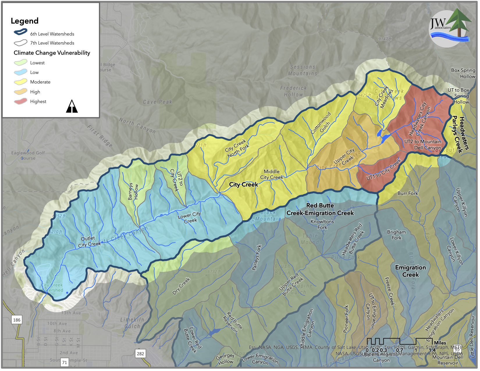
Emigration Creek


Little Cottonwood


Mill Creek


Parleys Creek


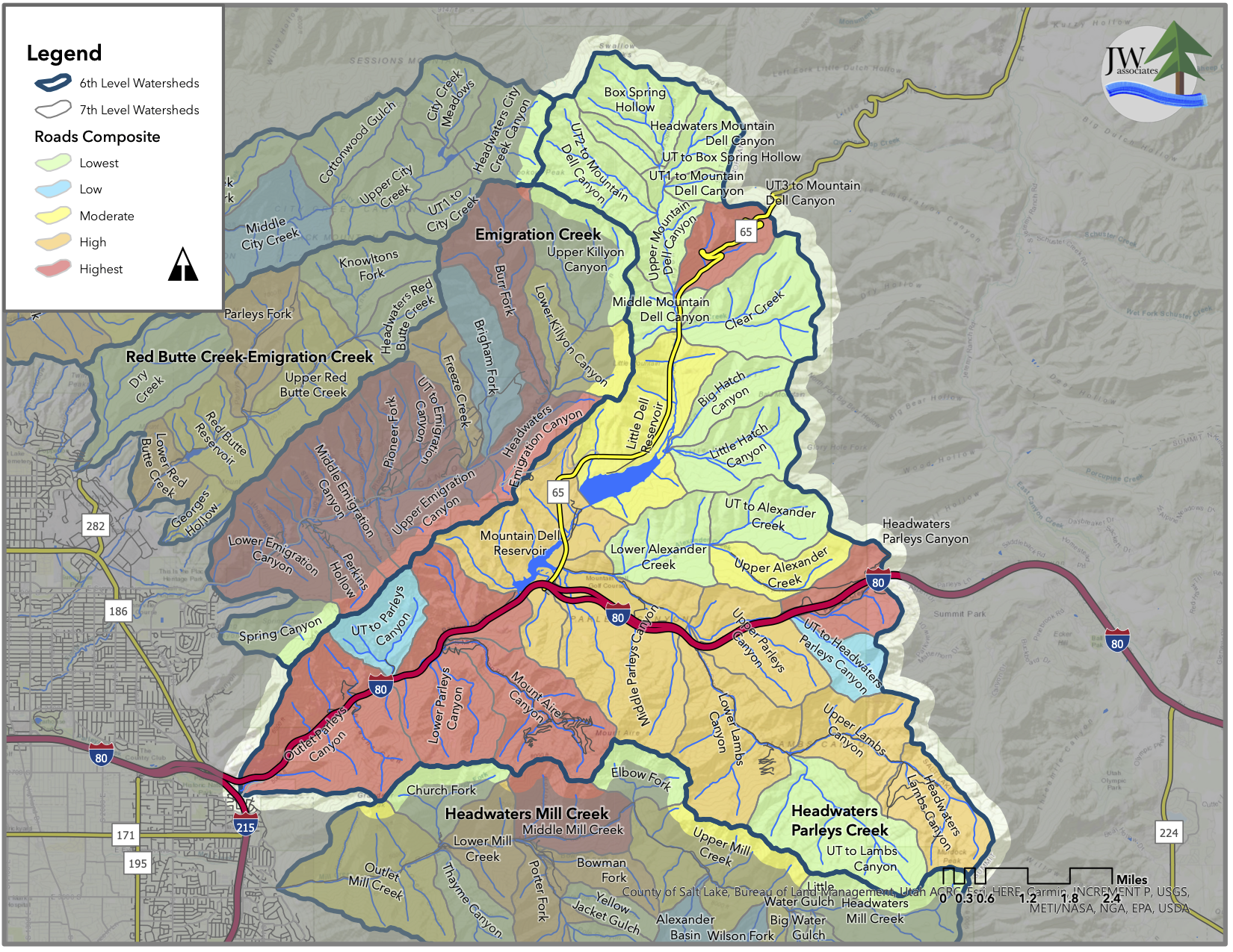


Red Butte